USGS Earthquakes (M4.5+)Oficial
Desastres e alertas
há 2 h
M 5.2 - 112 km SSE of Tateyama, Japan
Time 2026-11-21 10:09:05 UTC 2026-11-21 10:09:05 UTC at epicenter Location 34.011°N 140.211°E Depth 10.00 km (6.21 mi)
Ler em U.S. Geological Survey ↗Get the full Brivfy experience on your smartphone app.
Avisos, alertas e recomendações direto de governos, agências da ONU e órgãos públicos. Cada item tem link para o original.
USGS Earthquakes (M4.5+)Oficial
Desastres e alertas
há 2 h
Time 2026-11-21 10:09:05 UTC 2026-11-21 10:09:05 UTC at epicenter Location 34.011°N 140.211°E Depth 10.00 km (6.21 mi)
Ler em U.S. Geological Survey ↗USGS Earthquakes (M4.5+)Oficial
Desastres e alertas
há 2 h
PAGER - YELLOW ShakeMap - VII Time 2026-11-21 10:45:33 UTC 2026-11-21 10:45:33 UTC at epicenter Location 37.196°N 96.640°E Depth 10.00 km (6.21 mi)
Ler em U.S. Geological Survey ↗GDACS Disaster AlertsOficial
Desastres e alertas
há 2 h
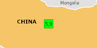
On 11/21/2026 10:45:33 AM, an earthquake occurred in China potentially affecting Few people affected (in MMI>=VII). The earthquake had Magnitude 5.9M, Depth:10km.
Ler em UN & European Commission ↗GDACS Disaster AlertsOficial
Desastres e alertas
há 3 h
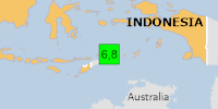
On 11/21/2026 9:42:10 AM, an earthquake occurred in Indonesia potentially affecting 50 thousand in MMI V. The earthquake had Magnitude 6.8M, Depth:143.423km.
Ler em UN & European Commission ↗USGS Earthquakes (M4.5+)Oficial
Desastres e alertas
há 3 h
Time 2026-11-21 09:42:10 UTC 2026-11-21 09:42:10 UTC at epicenter Location 7.756°S 127.543°E Depth 143.42 km (89.12 mi)
Ler em U.S. Geological Survey ↗USGS Earthquakes (M4.5+)Oficial
Desastres e alertas
há 6 h
Time 2026-11-21 07:20:44 UTC 2026-11-21 07:20:44 UTC at epicenter Location 17.179°S 168.100°E Depth 43.23 km (26.86 mi)
Ler em U.S. Geological Survey ↗USGS Earthquakes (M4.5+)Oficial
Desastres e alertas
há 8 h
Time 2026-11-21 05:12:04 UTC 2026-11-21 05:12:04 UTC at epicenter Location 10.913°S 76.031°W Depth 110.93 km (68.93 mi)
Ler em U.S. Geological Survey ↗USGS Earthquakes (M4.5+)Oficial
Desastres e alertas
há 10 h
Time 2026-11-21 02:24:37 UTC 2026-11-21 02:24:37 UTC at epicenter Location 58.546°N 31.857°W Depth 10.00 km (6.21 mi)
Ler em U.S. Geological Survey ↗USGS Earthquakes (M4.5+)Oficial
Desastres e alertas
há 11 h
Time 2026-11-21 01:26:19 UTC 2026-11-21 01:26:19 UTC at epicenter Location 58.302°N 31.761°W Depth 10.00 km (6.21 mi)
Ler em U.S. Geological Survey ↗USGS Earthquakes (M4.5+)Oficial
Desastres e alertas
há 12 h
Time 2026-11-21 01:24:09 UTC 2026-11-21 01:24:09 UTC at epicenter Location 22.231°S 68.641°W Depth 120.01 km (74.57 mi)
Ler em U.S. Geological Survey ↗USGS Earthquakes (M4.5+)Oficial
Desastres e alertas
há 13 h
DYFI? - IV Time 2026-11-21 00:09:19 UTC 2026-11-21 00:09:19 UTC at epicenter Location 10.855°S 75.978°W Depth 107.99 km (67.10 mi)
Ler em U.S. Geological Survey ↗GDACS Disaster AlertsOficial
Desastres e alertas
há 13 h
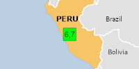
On 11/21/2026 12:09:19 AM, an earthquake occurred in Peru potentially affecting 2 thousand in MMI VI. The earthquake had Magnitude 6.7M, Depth:107.991km.
Ler em UN & European Commission ↗GDACS Disaster AlertsOficial
Desastres e alertas
há 13 h
On 17/11/2026, a forest fire started in Australia, until 20/11/2026.
Ler em UN & European Commission ↗USGS Earthquakes (M4.5+)Oficial
Desastres e alertas
há 14 h
Time 2026-11-20 22:34:39 UTC 2026-11-20 22:34:39 UTC at epicenter Location 20.320°S 173.410°W Depth 10.00 km (6.21 mi)
Ler em U.S. Geological Survey ↗U.S. Weather Alerts (extreme)Oficial
Desastres e alertas · US
há 15 h
TORMTR The National Weather Service in San Francisco has issued a * Tornado Warning for... Northeastern San Benito County in central California... * Until 315 PM PST. * At 223 PM PST, a severe thunderstorm capable of producing a tornado was located 18 miles east of Ridgemark, or 20 miles east of Hollister, moving southeast at 20 mph. HAZARD...Tornado. SOURCE...Radar indicated rotation. IMPACT...Flying debris will be dangerous to those caught without shelter. Mobile homes will be damaged or destroyed. Damage to roofs, windows and vehicles will occur. Tree damage is likely. * Locations…
Ler em U.S. National Weather Service ↗U.S. Weather Alerts (extreme)Oficial
Desastres e alertas · US
há 15 h
TORHNX The National Weather Service in Hanford has issued a * Tornado Warning for... Southwestern Merced County in central California... * Until 300 PM PST. * At 223 PM PST, A severe thunderstorm capable of producing a tornado was located 18 miles southwest of Los Banos, or 42 miles southwest of Atwater, moving south at 15 mph. HAZARD...Tornado. SOURCE...Radar indicated rotation. IMPACT...Flying debris will be dangerous to those caught without shelter. Mobile homes will be damaged or destroyed. Damage to roofs, windows and vehicles will occur. Tree damage is likely. * Locations impacted…
Ler em U.S. National Weather Service ↗GDACS Disaster AlertsOficial
Desastres e alertas
há 17 h
On 18/11/2026, a forest fire started in South Africa, until 20/11/2026.
Ler em UN & European Commission ↗GDACS Disaster AlertsOficial
Desastres e alertas
há 17 h
On 18/11/2026, a forest fire started in South Sudan, until 20/11/2026.
Ler em UN & European Commission ↗GDACS Disaster AlertsOficial
Desastres e alertas
há 17 h
On 18/11/2026, a forest fire started in South Sudan, Central African Republic, until 20/11/2026.
Ler em UN & European Commission ↗USGS Earthquakes (M4.5+)Oficial
Desastres e alertas
há 19 h
Time 2026-11-20 17:53:15 UTC 2026-11-20 17:53:15 UTC at epicenter Location 14.835°S 167.290°E Depth 94.53 km (58.74 mi)
Ler em U.S. Geological Survey ↗USGS Earthquakes (M4.5+)Oficial
Desastres e alertas
há 22 h
Time 2026-11-20 14:16:15 UTC 2026-11-20 14:16:15 UTC at epicenter Location 31.784°S 72.149°W Depth 10.00 km (6.21 mi)
Ler em U.S. Geological Survey ↗USGS Earthquakes (M4.5+)Oficial
Desastres e alertas
há 1 dia
Time 2026-11-20 13:09:04 UTC 2026-11-20 13:09:04 UTC at epicenter Location 5.444°N 125.299°E Depth 73.39 km (45.60 mi)
Ler em U.S. Geological Survey ↗GDACS Disaster AlertsOficial
Desastres e alertas
há 1 dia
On 17/11/2026, a forest fire started in Australia, until 20/11/2026.
Ler em UN & European Commission ↗GDACS Disaster AlertsOficial
Desastres e alertas
há 1 dia
On 18/11/2026, a forest fire started in Australia, until 20/11/2026.
Ler em UN & European Commission ↗