USGS Earthquakes (M4.5+)官方
灾害与警报
3天前
M 5.0 - 46 km NNE of Kilimatinde, Tanzania
Time 2026-11-18 18:08:00 UTC 2026-11-18 18:08:00 UTC at epicenter Location 5.460°S 35.107°E Depth 10.00 km (6.21 mi)
在U.S. Geological Survey阅读 ↗Get the full Brivfy experience on your smartphone app.
来自各国政府、联合国机构和公共机构的通告、警报和建议。每条内容都附有原文链接。
自动翻译,原文为英文。
USGS Earthquakes (M4.5+)官方
灾害与警报
3天前
Time 2026-11-18 18:08:00 UTC 2026-11-18 18:08:00 UTC at epicenter Location 5.460°S 35.107°E Depth 10.00 km (6.21 mi)
在U.S. Geological Survey阅读 ↗USGS Earthquakes (M4.5+)官方
灾害与警报
3天前
DYFI? - II Time 2026-11-18 17:22:23 UTC 2026-11-18 17:22:23 UTC at epicenter Location 32.278°N 130.461°E Depth 10.00 km (6.21 mi)
在U.S. Geological Survey阅读 ↗USGS Earthquakes (M4.5+)官方
灾害与警报
3天前
Time 2026-11-18 16:06:51 UTC 2026-11-18 16:06:51 UTC at epicenter Location 12.092°N 143.993°E Depth 10.00 km (6.21 mi)
在U.S. Geological Survey阅读 ↗GDACS Disaster Alerts官方
灾害与警报
3天前
On 16/11/2026, a forest fire started in Australia, until 18/11/2026.
在UN & European Commission阅读 ↗GDACS Disaster Alerts官方
灾害与警报
3天前
On 17/11/2026, a forest fire started in Australia, until 18/11/2026.
在UN & European Commission阅读 ↗USGS Earthquakes (M4.5+)官方
灾害与警报
3天前
Time 2026-11-18 11:10:57 UTC 2026-11-18 11:10:57 UTC at epicenter Location 39.691°S 91.503°W Depth 10.00 km (6.21 mi)
在U.S. Geological Survey阅读 ↗U.S. Weather Alerts (extreme)官方
灾害与警报 · US
3天前
* WHAT...Blizzard conditions expected. Total snow accumulations of 2 to 5 inches. Winds could gust as high as 70 mph. * WHERE...St Lawrence Island. * WHEN...Until 3 PM AKST Thursday. * IMPACTS...Travel could be very difficult. Snow and blowing snow could reduce visibility below one quarter mile at times. Strong winds could result in power outages. * ADDITIONAL DETAILS...Snow expected Tuesday night into Wednesday as winds peak. Snow may mix with rain at times Wednesday and Thursday. When mixed with rain, visibility is expected to improve, but periods of whiteout conditions remain possible.
在U.S. National Weather Service阅读 ↗USGS Earthquakes (M4.5+)官方
灾害与警报
3天前
DYFI? - II Time 2026-11-18 09:37:00 UTC 2026-11-18 09:37:00 UTC at epicenter Location 38.719°N 137.873°E Depth 10.00 km (6.21 mi)
在U.S. Geological Survey阅读 ↗GDACS Disaster Alerts官方
灾害与警报
3天前
On 17/11/2026, a forest fire started in South Africa, until 18/11/2026.
在UN & European Commission阅读 ↗USGS Earthquakes (M4.5+)官方
灾害与警报
3天前
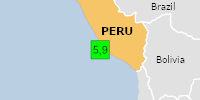
PAGER - GREEN ShakeMap - IV DYFI? - V Time 2026-11-18 06:07:42 UTC 2026-11-18 06:07:42 UTC at epicenter Location 15.144°S 75.924°W Depth 21.90 km (13.60 mi)
在U.S. Geological Survey阅读 ↗GDACS Disaster Alerts官方
灾害与警报
3天前
On 11/18/2026 6:07:42 AM, an earthquake occurred in Peru potentially affecting 40 thousand in MMI IV. The earthquake had Magnitude 5.9M, Depth:21.895km.
在UN & European Commission阅读 ↗USGS Earthquakes (M4.5+)官方
灾害与警报
3天前
Time 2026-11-18 05:24:55 UTC 2026-11-18 05:24:55 UTC at epicenter Location 8.030°S 120.649°E Depth 10.00 km (6.21 mi)
在U.S. Geological Survey阅读 ↗USGS Earthquakes (M4.5+)官方
灾害与警报
3天前
Time 2026-11-18 05:25:43 UTC 2026-11-18 05:25:43 UTC at epicenter Location 0.435°N 103.084°W Depth 10.00 km (6.21 mi)
在U.S. Geological Survey阅读 ↗USGS Earthquakes (M4.5+)官方
灾害与警报
3天前
Time 2026-11-18 00:46:31 UTC 2026-11-18 00:46:31 UTC at epicenter Location 39.191°N 71.588°E Depth 10.00 km (6.21 mi)
在U.S. Geological Survey阅读 ↗USGS Earthquakes (M4.5+)官方
灾害与警报
3天前
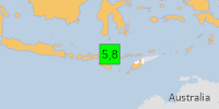
PAGER - GREEN ShakeMap - VII Time 2026-11-18 04:41:32 UTC 2026-11-18 04:41:32 UTC at epicenter Location 8.250°S 120.529°E Depth 10.00 km (6.21 mi)
在U.S. Geological Survey阅读 ↗GDACS Disaster Alerts官方
灾害与警报
3天前
On 11/18/2026 4:41:32 AM, an earthquake occurred in Indonesia potentially affecting 6 thousand (in MMI>=VII). The earthquake had Magnitude 5.8M, Depth:10km.
在UN & European Commission阅读 ↗USGS Earthquakes (M4.5+)官方
灾害与警报
3天前
Time 2026-11-18 04:21:35 UTC 2026-11-18 04:21:35 UTC at epicenter Location 8.151°S 120.649°E Depth 10.00 km (6.21 mi)
在U.S. Geological Survey阅读 ↗USGS Earthquakes (M4.5+)官方
灾害与警报
3天前
Time 2026-11-17 23:25:33 UTC 2026-11-17 23:25:33 UTC at epicenter Location 13.022°N 57.688°E Depth 10.00 km (6.21 mi)
在U.S. Geological Survey阅读 ↗USGS Earthquakes (M4.5+)官方
灾害与警报
3天前
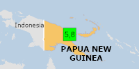
PAGER - GREEN ShakeMap - IV DYFI? - II Time 2026-11-18 03:42:34 UTC 2026-11-18 03:42:34 UTC at epicenter Location 5.701°S 146.548°E Depth 52.29 km (32.49 mi)
在U.S. Geological Survey阅读 ↗GDACS Disaster Alerts官方
灾害与警报
3天前
On 11/18/2026 3:42:34 AM, an earthquake occurred in Papua New Guinea potentially affecting 120 thousand in MMI IV. The earthquake had Magnitude 5.8M, Depth:52.291km.
在UN & European Commission阅读 ↗USGS Earthquakes (M4.5+)官方
灾害与警报
3天前
Time 2026-11-18 03:23:58 UTC 2026-11-18 03:23:58 UTC at epicenter Location 2.991°S 136.658°E Depth 10.00 km (6.21 mi)
在U.S. Geological Survey阅读 ↗USGS Earthquakes (M4.5+)官方
灾害与警报
3天前
PAGER - GREEN ShakeMap - I DYFI? - III Time 2026-11-18 02:22:56 UTC 2026-11-18 02:22:56 UTC at epicenter Location 12.139°N 143.887°E Depth 10.00 km (6.21 mi)
在U.S. Geological Survey阅读 ↗GDACS Disaster Alerts官方
灾害与警报
3天前
On 11/18/2026 2:22:56 AM, an earthquake occurred in South Of Mariana Islands potentially affecting [unknown]. The earthquake had Magnitude 5.8M, Depth:10km.
在UN & European Commission阅读 ↗USGS Earthquakes (M4.5+)官方
灾害与警报
4天前
DYFI? - IV Time 2026-11-18 00:48:56 UTC 2026-11-18 00:48:56 UTC at epicenter Location 45.680°N 26.489°E Depth 130.76 km (81.25 mi)
在U.S. Geological Survey阅读 ↗