USGS Earthquakes (M4.5+)官方
灾害与警报
5天前
M 4.8 - 28 km SW of Changuillo, Peru
Time 2026-11-16 16:23:18 UTC 2026-11-16 16:23:18 UTC at epicenter Location 14.836°S 75.423°W Depth 39.09 km (24.29 mi)
在U.S. Geological Survey阅读 ↗Get the full Brivfy experience on your smartphone app.
来自各国政府、联合国机构和公共机构的通告、警报和建议。每条内容都附有原文链接。
自动翻译,原文为英文。
USGS Earthquakes (M4.5+)官方
灾害与警报
5天前
Time 2026-11-16 16:23:18 UTC 2026-11-16 16:23:18 UTC at epicenter Location 14.836°S 75.423°W Depth 39.09 km (24.29 mi)
在U.S. Geological Survey阅读 ↗USGS Earthquakes (M4.5+)官方
灾害与警报
5天前
PAGER - GREEN ShakeMap - IV Time 2026-11-16 16:16:45 UTC 2026-11-16 16:16:45 UTC at epicenter Location 15.031°S 76.026°W Depth 10.00 km (6.21 mi)
在U.S. Geological Survey阅读 ↗GDACS Disaster Alerts官方
灾害与警报
5天前
On 12/11/2026, a forest fire started in Nigeria, until 16/11/2026.
在UN & European Commission阅读 ↗USGS Earthquakes (M4.5+)官方
灾害与警报
5天前
时间 2026-11-16 13:32:25 UTC 2026-11-16 13:32:25 UTC(震中) 位置 26.849°N 129.631°E 深度 10.00公里(6.21英里)
在U.S. Geological Survey阅读 ↗USGS Earthquakes (M4.5+)官方
灾害与警报
5天前
时间 2026-11-16 13:30:33 UTC 2026-11-16 13:30:33 UTC(震中) 位置 13.474°N 50.742°E 深度 10.00公里(6.21英里)
在U.S. Geological Survey阅读 ↗USGS Earthquakes (M4.5+)官方
灾害与警报
5天前
时间 2026-11-16 13:25:21 UTC 2026-11-16 13:25:21 UTC 震中 位置 49.984°N 155.917°E 深度 85.01公里(52.82英里)
在U.S. Geological Survey阅读 ↗GDACS Disaster Alerts官方
灾害与警报
GDACS Disaster Alerts官方
灾害与警报
GDACS Disaster Alerts官方
灾害与警报
GDACS Disaster Alerts官方
灾害与警报
USGS Earthquakes (M4.5+)官方
灾害与警报
5天前
时间 2026-11-16 07:14:14 UTC 2026-11-16 07:14:14 UTC(震中) 位置 4.784°N 125.427°E 深度 10.00公里(6.21英里)
在U.S. Geological Survey阅读 ↗GDACS Disaster Alerts官方
灾害与警报
5天前
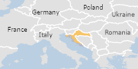
2026年11月12日,克罗地亚发生洪水,持续至2026年11月14日(最近更新)。此次洪水造成0人死亡,13人流离失所。
在UN & European Commission阅读 ↗USGS Earthquakes (M4.5+)官方
灾害与警报
5天前
PAGER - 绿色 ShakeMap - III 时间 2026-11-16 04:24:11 UTC 2026-11-16 04:24:11 UTC(震中) 位置 37.185°N 136.979°E 深度 286.10公里(177.77英里)
在U.S. Geological Survey阅读 ↗GDACS Disaster Alerts官方
灾害与警报
GDACS Disaster Alerts官方
灾害与警报
GDACS Disaster Alerts官方
灾害与警报
GDACS Disaster Alerts官方
灾害与警报
GDACS Disaster Alerts官方
灾害与警报
USGS Earthquakes (M4.5+)官方
灾害与警报
6天前
时间 2026-11-15 22:38:19 UTC 2026-11-15 22:38:19 UTC(震中) 位置 52.494°N 160.494°E 深度 10.00公里(6.21英里)
在U.S. Geological Survey阅读 ↗USGS Earthquakes (M4.5+)官方
灾害与警报
6天前
时间 2026-11-15 21:37:22 UTC 2026-11-15 21:37:22 UTC(震中) 位置 36.516°N 70.792°E 深度 197.00公里(122.41英里)
在U.S. Geological Survey阅读 ↗USGS Earthquakes (M4.5+)官方
灾害与警报
6天前
时间 2026-11-15 20:51:56 UTC 2026-11-15 20:51:56 UTC(震中) 位置 5.945°S 128.752°E 深度 305.99公里(190.13英里)
在U.S. Geological Survey阅读 ↗GDACS Disaster Alerts官方
灾害与警报
GDACS Disaster Alerts官方
灾害与警报
GDACS Disaster Alerts官方
灾害与警报