USGS Earthquakes (M4.5+)官方
灾害与警报
6天前
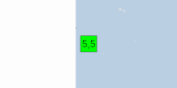
M 5.5 - 斐济地区
PAGER - 绿色 ShakeMap - II 时间 2026-11-15 05:15:02 UTC 2026-11-15 05:15:02 UTC(震中)位置 19.555°S 177.822°W 深度 469.88 公里(291.97 英里)
在U.S. Geological Survey阅读 ↗Get the full Brivfy experience on your smartphone app.
来自各国政府、联合国机构和公共机构的通告、警报和建议。每条内容都附有原文链接。
自动翻译,原文为英文。
USGS Earthquakes (M4.5+)官方
灾害与警报
6天前
PAGER - 绿色 ShakeMap - II 时间 2026-11-15 05:15:02 UTC 2026-11-15 05:15:02 UTC(震中)位置 19.555°S 177.822°W 深度 469.88 公里(291.97 英里)
在U.S. Geological Survey阅读 ↗GDACS Disaster Alerts官方
灾害与警报
6天前
2026年11月15日上午5:15:02,斐济发生一次地震,可能影响100公里范围内的少量人口。该地震震级为5.5M,震源深度:469.881公里。
在UN & European Commission阅读 ↗GDACS Disaster Alerts官方
灾害与警报
GDACS Disaster Alerts官方
灾害与警报
USGS Earthquakes (M4.5+)官方
灾害与警报
6天前
时间 2026-11-15 03:59:59 UTC 2026-11-15 03:59:59 UTC(震中)位置 31.322°S 68.682°W 深度 108.94 公里(67.69 英里)
在U.S. Geological Survey阅读 ↗GDACS Disaster Alerts官方
灾害与警报
GDACS Disaster Alerts官方
灾害与警报
GDACS Disaster Alerts官方
灾害与警报
GDACS Disaster Alerts官方
灾害与警报
USGS Earthquakes (M4.5+)官方
灾害与警报
7天前
时间 2026-11-14 22:23:46 UTC 2026-11-14 22:23:46 UTC(震中) 位置 3.732°N 99.113°W 深度 10.00公里(6.21英里)
在U.S. Geological Survey阅读 ↗USGS Earthquakes (M4.5+)官方
灾害与警报
7天前
时间 2026-11-14 21:24:20 UTC 2026-11-14 21:24:20 UTC(震中) 位置 8.382°S 120.443°E 深度 10.00公里(6.21英里)
在U.S. Geological Survey阅读 ↗GDACS Disaster Alerts官方
灾害与警报
USGS Earthquakes (M4.5+)官方
灾害与警报
7天前
时间 2026-11-14 18:04:01 UTC 2026-11-14 18:04:01 UTC(震中) 位置 22.236°S 63.653°W 深度 506.27公里(314.58英里)
在U.S. Geological Survey阅读 ↗USGS Earthquakes (M4.5+)官方
灾害与警报
7天前
时间 2026-11-14 16:56:39 UTC 2026-11-14 16:56:39 UTC(震中) 位置 5.598°N 126.610°E 深度 65.40公里(40.64英里)
在U.S. Geological Survey阅读 ↗USGS Earthquakes (M4.5+)官方
灾害与警报
7天前
Time 2026-11-14 16:36:19 UTC 2026-11-14 16:36:19 UTC at epicenter Location 24.049°S 66.903°W Depth 197.57 km (122.76 mi)
在U.S. Geological Survey阅读 ↗GDACS Disaster Alerts官方
灾害与警报
7天前
On 11/11/2026, a forest fire started in Sudan, South Sudan, until 14/11/2026.
在UN & European Commission阅读 ↗USGS Earthquakes (M4.5+)官方
灾害与警报
7天前
Time 2026-11-14 16:04:22 UTC 2026-11-14 16:04:22 UTC at epicenter Location 8.400°N 126.211°E Depth 154.12 km (95.77 mi)
在U.S. Geological Survey阅读 ↗USGS Earthquakes (M4.5+)官方
灾害与警报
7天前
Time 2026-11-14 13:17:20 UTC 2026-11-14 13:17:20 UTC at epicenter Location 33.002°S 178.340°W Depth 12.02 km (7.47 mi)
在U.S. Geological Survey阅读 ↗USGS Earthquakes (M4.5+)官方
灾害与警报
7天前
Time 2026-11-14 12:28:00 UTC 2026-11-14 12:28:00 UTC at epicenter Location 52.360°N 160.298°E Depth 17.44 km (10.84 mi)
在U.S. Geological Survey阅读 ↗USGS Earthquakes (M4.5+)官方
灾害与警报
7天前
PAGER - GREEN ShakeMap - I Time 2026-11-14 09:26:13 UTC 2026-11-14 09:26:13 UTC at epicenter Location 30.122°N 42.635°W Depth 10.00 km (6.21 mi)
在U.S. Geological Survey阅读 ↗GDACS Disaster Alerts官方
灾害与警报
7天前
On 11/14/2026 9:26:13 AM, an earthquake occurred in Northern Mid-Atlantic Ridge potentially affecting [unknown]. The earthquake had Magnitude 5.5M, Depth:10km.
在UN & European Commission阅读 ↗GDACS Disaster Alerts官方
灾害与警报
7天前
On 11/11/2026, a forest fire started in Australia, until 13/11/2026.
在UN & European Commission阅读 ↗GDACS Disaster Alerts官方
灾害与警报
7天前
On 11/11/2026, a forest fire started in Australia, until 14/11/2026.
在UN & European Commission阅读 ↗GDACS Disaster Alerts官方
灾害与警报
7天前
On 11/11/2026, a forest fire started in Australia, until 13/11/2026.
在UN & European Commission阅读 ↗