ข้อมูลจากแหล่งทางการ

ประกาศ การเตือนภัย และคำแนะนำจากหน่วยงานรัฐและองค์กรระหว่างประเทศ ลิงก์ไปยังต้นฉบับทุกครั้ง

แปลโดยอัตโนมัติ ต้นฉบับเป็นภาษาอังกฤษ

U.S. Weather Alerts (extreme)ทางการ

ภัยพิบัติและการเตือนภัย · US

5 วันที่แล้ว

Hurricane Force Wind Warning issued November 16 at 4:01PM AKST until November 17 at 5:00AM AKST by NWS Anchorage AK

Coastal Waters Forecast for Southwest Alaska+Bristol Bay+The Alaska Peninsula Waters and the Aleutian Islands up to 100 nm out. Wind forecasts reflect the predominant speed and direction expected. Sea forecasts represent an average of the highest one-third of the combined wind wave and swell height. .TONIGHT...S wind 45 kt becoming SW 65 kt after midnight. Seas 20 ft building to 29 ft after midnight. Rain. .TUE...W wind 60 kt diminishing to 50 kt in the afternoon. Seas 28 ft. .TUE NIGHT...W wind 45 kt diminishing to 35 kt after midnight. Seas 23 ft. .WED AND WED NIGHT...W wind 40 kt. Seas 19…

อ่านต่อที่ U.S. National Weather Service ↗

USGS Earthquakes (M4.5+)ทางการ

ภัยพิบัติและการเตือนภัย
5 วันที่แล้ว

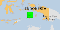
แผ่นดินไหวขนาด 6.6 - ห่างจากเมืองตูอัล ประเทศอินโดนีเซีย ไปทางตะวันตกเฉียงใต้ 151 กม.

PAGER - สีเขียว ShakeMap - V DYFI? - III เวลา 2026-11-16 21:11:17 UTC 2026-11-16 21:11:17 UTC ณ จุดศูนย์กลางแผ่นดินไหว ตำแหน่ง 6.029°S 131.446°E ความลึก 35.00 กม. (21.75 ไมล์)

อ่านต่อที่ U.S. Geological Survey ↗
U.S. Weather Alerts (extreme)ทางการ

ภัยพิบัติและการเตือนภัย · US

5 วันที่แล้ว

Blizzard Warning issued November 16 at 12:15PM AKST until November 19 at 3:00PM AKST by NWS Fairbanks AK

* WHAT...Blizzard conditions expected. Total snow accumulations of 2 to 5 inches. Winds could gust as high as 70 mph. * WHERE...St Lawrence Island. * WHEN...From 3 PM Tuesday to 3 PM AKST Thursday. * IMPACTS...Travel could be very difficult. Snow and blowing snow could reduce visibility below one quarter mile at times. Strong winds could result in power outages. * ADDITIONAL DETAILS...Strong winds will steadily ramp up Tuesday into Tuesday night, with snow arriving Tuesday night into Wednesday as winds peak.

อ่านต่อที่ U.S. National Weather Service ↗

U.S. Weather Alerts (extreme)ทางการ

ภัยพิบัติและการเตือนภัย · US

5 วันที่แล้ว

Tornado Warning issued November 16 at 1:07PM PST until November 16 at 1:30PM PST by NWS San Francisco CA

At 107 PM PST, a severe thunderstorm capable of producing a tornado was located 6 miles west of Santa Cruz, moving southeast at 15 mph. HAZARD...Tornado. SOURCE...Radar indicated rotation. IMPACT...Expect damage to mobile homes, roofs, and vehicles. Locations impacted include... Mainly rural areas of West Central Santa Cruz County.

อ่านต่อที่ U.S. National Weather Service ↗

U.S. Weather Alerts (extreme)ทางการ

ภัยพิบัติและการเตือนภัย · US

5 วันที่แล้ว

Tornado Warning issued November 16 at 12:47PM PST until November 16 at 1:30PM PST by NWS San Francisco CA

TORMTR The National Weather Service in San Francisco has issued a * Tornado Warning for... West Central Santa Cruz County in northern California... * Until 130 PM PST. * At 1247 PM PST, a severe thunderstorm capable of producing a waterspout was located 8 miles southwest of Ben Lomond, or 10 miles west of Santa Cruz, moving southeast at 15 mph. HAZARD...Tornado. SOURCE...Radar indicated rotation. IMPACT...Expect damage to mobile homes, roofs, and vehicles. * Locations impacted include... Mainly rural areas of West Central Santa Cruz County. Possible waterspout over the ocean moving onshore.

อ่านต่อที่ U.S. National Weather Service ↗

U.S. Weather Alerts (extreme)ทางการ

ภัยพิบัติและการเตือนภัย · US

5 วันที่แล้ว

ประกาศเตือนภัยทอร์นาโด ออกเมื่อวันที่ 16 พฤศจิกายน เวลา 12:36 น. PST ถึงวันที่ 16 พฤศจิกายน เวลา 13:00 น. PST โดย NWS ซานฟรานซิสโก รัฐแคลิฟอร์เนีย

เมื่อเวลา 12:36 น. PST พายุฝนฟ้าคะนองรุนแรงที่อาจทำให้เกิดทอร์นาโดอยู่ใกล้เมืองบูลเดอร์ครีก หรืออยู่ห่างจากซานตาครูซไปทางตะวันตกเฉียงเหนือ 10 ไมล์ กำลังเคลื่อนตัวไปทางตะวันออกเฉียงใต้ด้วยความเร็ว 15 ไมล์ต่อชั่วโมง อันตราย...ทอร์นาโด แหล่งข้อมูล...เรดาร์ตรวจพบการหมุน ผลกระทบ...คาดว่าบ้านเคลื่อนที่ หลังคา และยานพาหนะจะได้รับความเสียหาย พื้นที่ที่ได้รับผลกระทบ ได้แก่... พื้นที่ชนบทเป็นส่วนใหญ่ทางตะวันตกตอนกลางของเคาน์ตีซานตาครูซ

อ่านต่อที่ U.S. National Weather Service ↗

U.S. Weather Alerts (extreme)ทางการ

ภัยพิบัติและการเตือนภัย · US

5 วันที่แล้ว

Tornado Warning issued November 16 at 12:16PM PST until November 16 at 1:00PM PST by NWS San Francisco CA

TORMTR The National Weather Service in San Francisco has issued a * Tornado Warning for... West Central Santa Cruz County in northern California... * Until 100 PM PST. * At 1216 PM PST, a severe thunderstorm capable of producing a tornado was located 6 miles west of Boulder Creek, or 15 miles northwest of Santa Cruz, moving southeast at 15 mph. HAZARD...Tornado. SOURCE...Radar indicated rotation. IMPACT...Expect damage to mobile homes, roofs, and vehicles. * Locations impacted include... Mainly rural areas of West Central Santa Cruz County.

อ่านต่อที่ U.S. National Weather Service ↗

GDACS Disaster Alertsทางการ

ภัยพิบัติและการเตือนภัย

5 วันที่แล้ว

Orange notification for tropical cyclone AKVAN-26. Population affected by Category 1 (120 km/h) wind speeds or higher is 0 (20.826 million in Tropical Storm).

From 16/11/2026 to 16/11/2026, a Tropical Storm (maximum wind speed of 93 km/h) AKVAN-26 was active in NorthIndian. The cyclone affects these countries: India (vulnerability High). Estimated population affected by category 1 (120 km/h) wind speeds or higher is 0 (20.826 million in tropical storm).

อ่านต่อที่ UN & European Commission ↗