GDACS Disaster AlertsOficial
Desastres y alertas

hace 6 d
Green forest fire notification in Chad
On 13/11/2026, a forest fire started in Chad, until 15/11/2026.
Leer en UN & European Commission ↗Get the full Brivfy experience on your smartphone app.
Avisos, alertas y recomendaciones directamente de gobiernos, agencias de la ONU y organismos públicos. Cada noticia enlaza al original.
Traducción automática. El original está en inglés.
GDACS Disaster AlertsOficial
Desastres y alertas
hace 6 d
On 13/11/2026, a forest fire started in Chad, until 15/11/2026.
Leer en UN & European Commission ↗GDACS Disaster AlertsOficial
Desastres y alertas
hace 6 d
On 13/11/2026, a forest fire started in South Sudan, until 15/11/2026.
Leer en UN & European Commission ↗GDACS Disaster AlertsOficial
Desastres y alertas
hace 6 d
On 14/11/2026, a forest fire started in Niger, Burkina Faso, until 15/11/2026.
Leer en UN & European Commission ↗USGS Earthquakes (M4.5+)Oficial
Desastres y alertas
hace 6 d
Time 2026-11-15 14:17:52 UTC 2026-11-15 14:17:52 UTC at epicenter Location 9.692°N 126.351°E Depth 10.00 km (6.21 mi)
Leer en U.S. Geological Survey ↗USGS Earthquakes (M4.5+)Oficial
Desastres y alertas
hace 6 d
Time 2026-11-15 17:48:36 UTC 2026-11-15 17:48:36 UTC at epicenter Location 36.095°N 70.950°E Depth 100.73 km (62.59 mi)
Leer en U.S. Geological Survey ↗GDACS Disaster AlertsOficial
Desastres y alertas
hace 6 d
On 11/11/2026, a forest fire started in Sudan, South Sudan, until 15/11/2026.
Leer en UN & European Commission ↗GDACS Disaster AlertsOficial
Desastres y alertas
hace 6 d
On 13/11/2026, a forest fire started in Sudan, South Sudan, until 15/11/2026.
Leer en UN & European Commission ↗USGS Earthquakes (M4.5+)Oficial
Desastres y alertas
hace 6 d
Time 2026-11-15 15:41:14 UTC 2026-11-15 15:41:14 UTC at epicenter Location 1.753°N 122.135°E Depth 487.38 km (302.85 mi)
Leer en U.S. Geological Survey ↗U.S. Weather Alerts (extreme)Oficial
Desastres y alertas · US
hace 6 d
* WHAT...Blizzard conditions. Winds gusting as high as 60 mph through Sunday. * WHERE...Central and Eastern Beaufort Sea Coast. * WHEN...Until noon AKST today. * IMPACTS...Travel could be difficult. Snow and blowing snow could reduce visibility below one half mile at times. Periods of blizzard conditions will be intermittently possible.
Leer en U.S. National Weather Service ↗U.S. Weather Alerts (extreme)Oficial
Desastres y alertas · US
hace 6 d
As snowfall diminishes, visibilities will improve. Some visibility reductions will remain as gusty winds continue through Monday before subsiding.
Leer en U.S. National Weather Service ↗USGS Earthquakes (M4.5+)Oficial
Desastres y alertas
hace 6 d
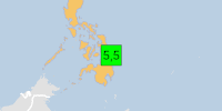
PAGER - GREEN ShakeMap - VI DYFI? - V Time 2026-11-15 13:41:35 UTC 2026-11-15 13:41:35 UTC at epicenter Location 9.760°N 126.200°E Depth 9.97 km (6.20 mi)
Leer en U.S. Geological Survey ↗GDACS Disaster AlertsOficial
Desastres y alertas
hace 6 d
On 11/15/2026 1:41:35 PM, an earthquake occurred in Philippines potentially affecting 30 thousand in MMI VI. The earthquake had Magnitude 5.5M, Depth:9.971km.
Leer en UN & European Commission ↗GDACS Disaster AlertsOficial
Desastres y alertas
hace 6 d
El 13/11/2026 se inició un incendio forestal en Australia, hasta el 15/11/2026.
Leer en UN & European Commission ↗GDACS Disaster AlertsOficial
Desastres y alertas
hace 6 d
El 14/11/2026 se inició un incendio forestal en Australia, hasta el 15/11/2026.
Leer en UN & European Commission ↗GDACS Disaster AlertsOficial
Desastres y alertas
hace 6 d
El 14/11/2026 se inició un incendio forestal en Australia, hasta el 15/11/2026.
Leer en UN & European Commission ↗U.S. Weather Alerts (extreme)Oficial
Desastres y alertas · US
hace 6 d
* QUÉ...Condiciones de ventisca. Acumulaciones adicionales de nieve de hasta una pulgada. Ráfagas de viento de hasta 60 mph durante el domingo. * DÓNDE...Costa central y oriental del mar de Beaufort. * CUÁNDO...Hasta el mediodía de hoy, hora AKST. * IMPACTOS...Viajar podría ser difícil. La nieve y la nieve arrastrada por el viento podrían reducir la visibilidad a menos de media milla en ocasiones. Podrían presentarse periodos intermitentes de condiciones de ventisca. * DETALLES ADICIONALES...Los vientos seguirán fuertes, con ráfagas de hasta 60 mph el domingo.
Leer en U.S. National Weather Service ↗U.S. Weather Alerts (extreme)Oficial
Desastres y alertas · US
hace 6 d
* QUÉ...Condiciones de ventisca. Acumulaciones adicionales de nieve de hasta una pulgada. Ráfagas de viento de hasta 60 mph durante el domingo. * DÓNDE...Costa central y oriental del mar de Beaufort. * CUÁNDO...Hasta las 7 AKST de esta mañana. * IMPACTOS...Viajar podría ser difícil. La nieve y la nieve arrastrada por el viento podrían reducir la visibilidad a menos de media milla en ocasiones. Podrían presentarse periodos intermitentes de condiciones de ventisca. * DETALLES ADICIONALES...Los vientos seguirán fuertes, con ráfagas de hasta 60 mph el domingo.
Leer en U.S. National Weather Service ↗Met Office Weather WarningsOficial
Desastres y alertas · GB
hace 6 d
Aviso amarillo por hielo que afecta a Dumfries, Galloway, Lothian y Borders: Dumfries and Galloway, East Lothian, Edimburgo, Midlothian Council, Scottish Borders, West Lothian, válido desde las 18:00 del domingo 15 de noviembre hasta las 10:00 del lunes 16 de noviembre
Leer en UK Met Office ↗GDACS Disaster AlertsOficial
Desastres y alertas
hace 6 d
From 15/11/2026 to 15/11/2026, a Tropical Storm (maximum wind speed of 148 km/h) FOUR-26 was active in SEPacific. The cyclone affects these countries: Cook Islands (vulnerability Medium). Estimated population affected by category 1 (120 km/h) wind speeds or higher is 0 (0 in tropical storm).
Leer en UN & European Commission ↗GDACS Disaster AlertsOficial
Desastres y alertas
hace 6 d
On 11/11/2026, a forest fire started in Nigeria, until 15/11/2026.
Leer en UN & European Commission ↗GDACS Disaster AlertsOficial
Desastres y alertas
hace 6 d
On 12/11/2026, a forest fire started in South Sudan, until 15/11/2026.
Leer en UN & European Commission ↗GDACS Disaster AlertsOficial
Desastres y alertas
hace 6 d
On 12/11/2026, a forest fire started in Burkina Faso, until 15/11/2026.
Leer en UN & European Commission ↗GDACS Disaster AlertsOficial
Desastres y alertas
hace 6 d
On 14/11/2026, a forest fire started in Burkina Faso, until 15/11/2026.
Leer en UN & European Commission ↗USGS Earthquakes (M4.5+)Oficial
Desastres y alertas
hace 6 d
Time 2026-11-15 07:36:37 UTC 2026-11-15 07:36:37 UTC at epicenter Location 20.589°S 175.935°W Depth 177.52 km (110.31 mi)
Leer en U.S. Geological Survey ↗