GDACS Disaster AlertsOfficial
Disasters & alerts

4 days ago
Green forest fire notification in Australia
On 15/11/2026, a forest fire started in Australia, until 17/11/2026.
Read on UN & European Commission ↗Get the full Brivfy experience on your smartphone app.
Notices, alerts and advisories straight from governments, UN agencies and public bodies. Every item links to the original.
GDACS Disaster AlertsOfficial
Disasters & alerts
4 days ago
On 15/11/2026, a forest fire started in Australia, until 17/11/2026.
Read on UN & European Commission ↗USGS Earthquakes (M4.5+)Official
Disasters & alerts
5 days ago
Time 2026-11-17 02:00:17 UTC 2026-11-17 02:00:17 UTC at epicenter Location 11.529°S 162.550°E Depth 10.00 km (6.21 mi)
Read on U.S. Geological Survey ↗U.S. Weather Alerts (extreme)Official
Disasters & alerts · US
5 days ago
Coastal Waters Forecast for Southwest Alaska+Bristol Bay+The Alaska Peninsula Waters and the Aleutian Islands up to 100 nm out. Wind forecasts reflect the predominant speed and direction expected. Sea forecasts represent an average of the highest one-third of the combined wind wave and swell height. .TONIGHT...S wind 45 kt becoming SW 65 kt after midnight. Seas 20 ft building to 29 ft after midnight. Rain. .TUE...W wind 60 kt diminishing to 50 kt in the afternoon. Seas 28 ft. .TUE NIGHT...W wind 45 kt diminishing to 35 kt after midnight. Seas 23 ft. .WED AND WED NIGHT...W wind 40 kt. Seas 19…
Read on U.S. National Weather Service ↗GDACS Disaster AlertsOfficial
Disasters & alerts
5 days ago
On 13/11/2026, a forest fire started in Australia, until 16/11/2026.
Read on UN & European Commission ↗GDACS Disaster AlertsOfficial
Disasters & alerts
5 days ago
On 14/11/2026, a forest fire started in Australia, until 16/11/2026.
Read on UN & European Commission ↗GDACS Disaster AlertsOfficial
Disasters & alerts
5 days ago
On 15/11/2026, a forest fire started in Australia, until 16/11/2026.
Read on UN & European Commission ↗USGS Earthquakes (M4.5+)Official
Disasters & alerts
5 days ago
Time 2026-11-16 19:33:00 UTC 2026-11-16 19:33:00 UTC at epicenter Location 1.721°S 149.806°E Depth 10.00 km (6.21 mi)
Read on U.S. Geological Survey ↗USGS Earthquakes (M4.5+)Official
Disasters & alerts
5 days ago
Time 2026-11-16 19:26:34 UTC 2026-11-16 19:26:34 UTC at epicenter Location 14.978°S 75.868°W Depth 10.00 km (6.21 mi)
Read on U.S. Geological Survey ↗USGS Earthquakes (M4.5+)Official
Disasters & alerts
5 days ago
Time 2026-11-16 21:55:58 UTC 2026-11-16 21:55:58 UTC at epicenter Location 20.767°S 169.818°E Depth 119.85 km (74.47 mi)
Read on U.S. Geological Survey ↗USGS Earthquakes (M4.5+)Official
Disasters & alerts
5 days ago
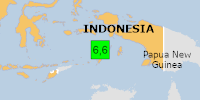
PAGER - GREEN ShakeMap - V DYFI? - III Time 2026-11-16 21:11:17 UTC 2026-11-16 21:11:17 UTC at epicenter Location 6.029°S 131.446°E Depth 35.00 km (21.75 mi)
Read on U.S. Geological Survey ↗GDACS Disaster AlertsOfficial
Disasters & alerts
5 days ago
On 11/16/2026 9:11:17 PM, an earthquake occurred in Indonesia potentially affecting 9 thousand in MMI>=IV. The earthquake had Magnitude 6.6M, Depth:35km.
Read on UN & European Commission ↗U.S. Weather Alerts (extreme)Official
Disasters & alerts · US
5 days ago
* WHAT...Blizzard conditions expected. Total snow accumulations of 2 to 5 inches. Winds could gust as high as 70 mph. * WHERE...St Lawrence Island. * WHEN...From 3 PM Tuesday to 3 PM AKST Thursday. * IMPACTS...Travel could be very difficult. Snow and blowing snow could reduce visibility below one quarter mile at times. Strong winds could result in power outages. * ADDITIONAL DETAILS...Strong winds will steadily ramp up Tuesday into Tuesday night, with snow arriving Tuesday night into Wednesday as winds peak.
Read on U.S. National Weather Service ↗U.S. Weather Alerts (extreme)Official
Disasters & alerts · US
5 days ago
At 107 PM PST, a severe thunderstorm capable of producing a tornado was located 6 miles west of Santa Cruz, moving southeast at 15 mph. HAZARD...Tornado. SOURCE...Radar indicated rotation. IMPACT...Expect damage to mobile homes, roofs, and vehicles. Locations impacted include... Mainly rural areas of West Central Santa Cruz County.
Read on U.S. National Weather Service ↗U.S. Weather Alerts (extreme)Official
Disasters & alerts · US
5 days ago
TORMTR The National Weather Service in San Francisco has issued a * Tornado Warning for... West Central Santa Cruz County in northern California... * Until 130 PM PST. * At 1247 PM PST, a severe thunderstorm capable of producing a waterspout was located 8 miles southwest of Ben Lomond, or 10 miles west of Santa Cruz, moving southeast at 15 mph. HAZARD...Tornado. SOURCE...Radar indicated rotation. IMPACT...Expect damage to mobile homes, roofs, and vehicles. * Locations impacted include... Mainly rural areas of West Central Santa Cruz County. Possible waterspout over the ocean moving onshore.
Read on U.S. National Weather Service ↗U.S. Weather Alerts (extreme)Official
Disasters & alerts · US
5 days ago
At 1236 PM PST, a severe thunderstorm capable of producing a tornado was located near Boulder Creek, or 10 miles northwest of Santa Cruz, moving southeast at 15 mph. HAZARD...Tornado. SOURCE...Radar indicated rotation. IMPACT...Expect damage to mobile homes, roofs, and vehicles. Locations impacted include... Mainly rural areas of West Central Santa Cruz County.
Read on U.S. National Weather Service ↗U.S. Weather Alerts (extreme)Official
Disasters & alerts · US
5 days ago
TORMTR The National Weather Service in San Francisco has issued a * Tornado Warning for... West Central Santa Cruz County in northern California... * Until 100 PM PST. * At 1216 PM PST, a severe thunderstorm capable of producing a tornado was located 6 miles west of Boulder Creek, or 15 miles northwest of Santa Cruz, moving southeast at 15 mph. HAZARD...Tornado. SOURCE...Radar indicated rotation. IMPACT...Expect damage to mobile homes, roofs, and vehicles. * Locations impacted include... Mainly rural areas of West Central Santa Cruz County.
Read on U.S. National Weather Service ↗GDACS Disaster AlertsOfficial
Disasters & alerts
5 days ago
From 16/11/2026 to 16/11/2026, a Tropical Storm (maximum wind speed of 93 km/h) AKVAN-26 was active in NorthIndian. The cyclone affects these countries: India (vulnerability High). Estimated population affected by category 1 (120 km/h) wind speeds or higher is 0 (20.826 million in tropical storm).
Read on UN & European Commission ↗GDACS Disaster AlertsOfficial
Disasters & alerts
5 days ago
On 12/11/2026, a forest fire started in Benin, Niger, Burkina Faso, until 16/11/2026.
Read on UN & European Commission ↗GDACS Disaster AlertsOfficial
Disasters & alerts
5 days ago
On 13/11/2026, a forest fire started in Burkina Faso, until 16/11/2026.
Read on UN & European Commission ↗USGS Earthquakes (M4.5+)Official
Disasters & alerts
5 days ago
Time 2026-11-16 16:23:18 UTC 2026-11-16 16:23:18 UTC at epicenter Location 14.836°S 75.423°W Depth 39.09 km (24.29 mi)
Read on U.S. Geological Survey ↗USGS Earthquakes (M4.5+)Official
Disasters & alerts
5 days ago
PAGER - GREEN ShakeMap - IV Time 2026-11-16 16:16:45 UTC 2026-11-16 16:16:45 UTC at epicenter Location 15.031°S 76.026°W Depth 10.00 km (6.21 mi)
Read on U.S. Geological Survey ↗GDACS Disaster AlertsOfficial
Disasters & alerts
5 days ago
On 12/11/2026, a forest fire started in Nigeria, until 16/11/2026.
Read on UN & European Commission ↗USGS Earthquakes (M4.5+)Official
Disasters & alerts
5 days ago
Time 2026-11-16 13:32:25 UTC 2026-11-16 13:32:25 UTC at epicenter Location 26.849°N 129.631°E Depth 10.00 km (6.21 mi)
Read on U.S. Geological Survey ↗USGS Earthquakes (M4.5+)Official
Disasters & alerts
5 days ago
Time 2026-11-16 13:30:33 UTC 2026-11-16 13:30:33 UTC at epicenter Location 13.474°N 50.742°E Depth 10.00 km (6.21 mi)
Read on U.S. Geological Survey ↗